Lidar Data Services
- Home
- Lidar Data Services
Lidar Data Services
- LMT is specialized in Lidar data services like Bare earth classification, Advanced classification, Power line classification for corridor and Advanced powerline classification. Our reliable geospatial services deliver successful projects using the latest technologies, proven methodologies, and innovative solutions.
- Our technical professionals have experience in the latest technologies and performing the data classification from various scanners.
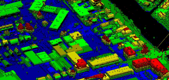
- With more than 10 years of experience, our team is one of the highly experienced teams to provide these services. To date we have completed more than 12 long-term projects using Airborne, Mobile and terrestrial Lidar data. The services include data post processing i.e. Point cloud data classification (Automated & Manual) to different classes like Bare earth, Buildings, Bridges, Hydrography, Low & High Vegetation, Towers, Catenaries etc., using Terra Scan, Micro Station, ArcGIS, and other Software.
Below are a few example screenshots from the projects which we have executed
successfully.

Key Features
How can we help you?
Contact the Landmark Mapping Technologies office closest to you, or simply submit your business inquiry online.

